
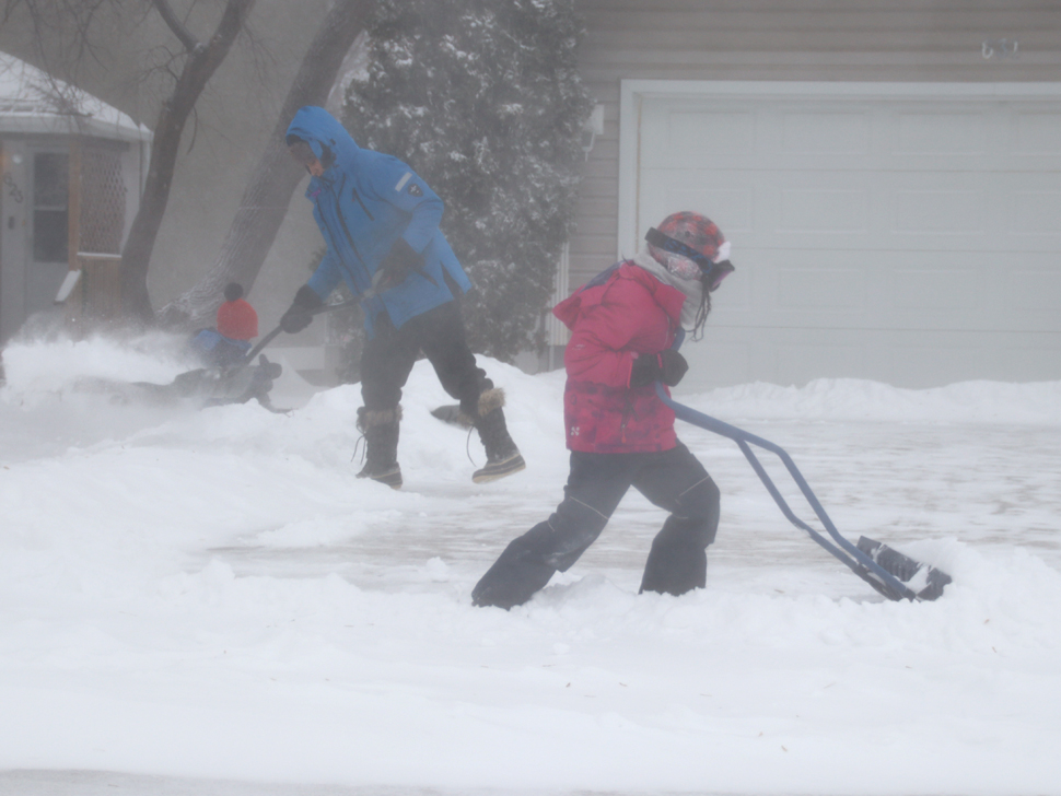
A Montana Low, which has been developing in Western Canada, is expected to hit Southeastern Manitoba later today.
Meteorologist Scott Kehler with Weatherlogics says the system has already brought snow across parts of Alberta and will land in Saskatchewan before hitting our province. He explains that the system will move out of Montana and then stall on Wednesday over Northern Minnesota, bringing quite a bit of snow to all of Southern Manitoba, beginning tonight.
First rain, then snow
Kehler says the first of the precipitation could fall as freezing rain or ice pellets. This is expected Tuesday night and into early Wednesday morning. However, he notes the freezing rain will probably not last very long. The bulk of the precipitation will fall as snow.
"It looks like the heavier snow will start to build early Wednesday morning," adds Kehler. "So, most likely when you get up on Wednesday the snow will have already started."
He notes the heaviest snow from this system will fall Wednesday morning. Kehler says Steinbach could see one to two centimetres of snow every hour Wednesday morning. The snow will continue throughout the day, but Kehler says by evening it will probably be lighter amounts. But, according to Kehler, this will be a stubborn system, lingering for a while.
"On Thursday and Friday, we're probably still going to see flurries continuing, not nearly as much snow as on Wednesday, but Thursday/ Friday could easily see another couple of centimetres each day as the system really is stubborn and doesn't want to leave our area," he explains.
Locations near U.S. border could see highest snowfall totals
For Steinbach, Kehler says snowfall amounts with this system will probably be between 10 and 20 centimetres, with the bulk of that falling on Wednesday. He notes areas in the far southeast, including Dominion City and Vita, could see 20 to 30 centimetres of snow. As for the Red River Valley, Kehler is expecting Winnipeg to receive 10 to 20 centimetres, while places like Emerson and towards Winkler and Morden could see more like 20 to 30 centimetres.
"It looks like the heaviest totals will be closer to the U.S. border, the snow will likely move into those areas a little bit earlier, and they will probably see the heavy snow last a bit longer," he explains.
According to Kehler, the winds with this storm will be a little unusual. He says normally with big snowstorms, winds increase as the system ramps up. But, Kehler says this one will be different. He notes winds Tuesday night and into Wednesday morning are expected to be from the east, gusting from 30 to 50 kilometres per hour (km/h). Kehler expects the winds to then die down and by Wednesday night and Thursday morning, they should be quite light.
"So, if you are travelling, the good news is that the visibility should be pretty good by Wednesday night and Thursday, but there still will be, of course, slippery roads from the snow," he points out. "As far as blowing snow is concerned, that will probably be at its worst Wednesday morning and then improve thereafter."
Expect colder weather once system leaves region
As for temperatures, Kehler says the air should cool considerably once the system exits the region. He notes that because of how stubborn this system will be, with light snow continuing Thursday and Friday, temperatures will not drop dramatically right away. Kehler anticipates much colder weather to set in for the weekend. On Saturday, Environment Canada is calling for a high of -13 degrees and an overnight low of -22 degrees.


 Tue, Feb 17, 3:00 PM
 Full-time, Permanent, Agriculture, Transport
 Featured